How thermal imaging from space could be used to see where your home is leaking heat
A pilot scheme shows how an aircraft can reveal which homes are poorly insulated so households can improve their carbon footprints and reduce energy bills

Bring your dream home to life with expert advice, how to guides and design inspiration. Sign up for our newsletter and get two free tickets to a Homebuilding & Renovating Show near you.
You are now subscribed
Your newsletter sign-up was successful
Space technology targeting poorly insulated homes has been successfully used for the first time in the UK.
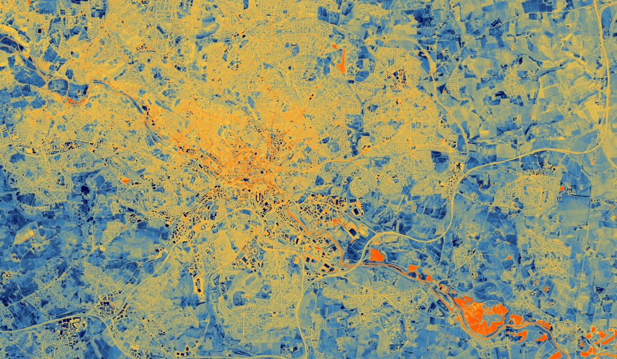
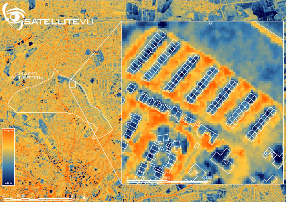
A pilot scheme in Leeds involved an aircraft, equipped with an advanced thermal imaging camera, flying over houses and then identifying which of the city's homes were expelling the most heat.
It is hoped the scheme will pave the way for more cities, both in the UK and abroad, to use the system to improve energy efficiency in homes, lower energy bills and help improve insulation when renovating a house.
What causes heat loss in homes?
As stated by the Leeds Climate Commission, approximately 25% of the carbon footprint in the city of Leeds is attributed to heating and powering residential buildings.
A significant factor contributing to this issue is the prevalence of poorly insulated roofs, walls, and windows, which result in substantial heat loss from properties. Poor external wall insulation can also be a factor as well as internal wall insulation.
This is partly what prompted Leeds Council to take part in the thermal imaging testing to identify which areas were suffering most from this.
How does the technology work?
Satellite Vu's camera is a tool that can identify the most energy-inefficient buildings in a large area. The technology uses thermal imaging to identify which homes are emitting the most heat, which can help show the homes that are the least energy-efficient. Those living in these properties can learn how to insulate old homes if this is the cause of the heat loss, or insulating a roof if the attic space is the main culprit for this.
Bring your dream home to life with expert advice, how to guides and design inspiration. Sign up for our newsletter and get two free tickets to a Homebuilding & Renovating Show near you.
Natalia Kuniewicz, Sales Representative at Satellite Vu, said: “We are thrilled to see the successful deployment of our aerial thermal imaging technology in Leeds, which represents a significant milestone towards our ultimate goal of mapping heat loss from individual buildings on a global scale."
The test was made possible through funding from the MCS Charitable Foundation, a net-zero-focused charity, in collaboration with Leeds City Council.
Dr. Richard Hauxwell-Baldwin, Research and Campaigns Manager at MCS Charitable Foundation, claimed: “With 29 million homes in the UK urgently needing upgrades to be fit for the future, we need detailed data on building conditions on a massive scale. This proof of concept could provide that data for the first time and will be game-changing for investment in whole-street and whole-area retrofitting programmes.”

How can this help tackle heat loss in homes?
Information gathered using the new technology can be used by local authorities to target and prioritise funding for homes most in need of energy-saving green upgrades.
Data collected from the Leeds pilot will be used to see how successful this study was in reducing heat loss so it could potentially be rolled out to other local authorities.
Leeds Council specifically intends to use insights from the test to help residents better understand the thermal efficiency of their properties and to encourage more retrofitting in the private sector.
The data can also be used to secure more funding for local area-based retrofit projects like those that have already had a transformative impact, such as the 'Holbeck Group Repair' scheme which saw around 300 of the city's oldest homes receive energy-saving upgrades including new roofs and external wall insulation that combined to cut energy use by 25-30%.
Councillor Helen Hayden, executive member for Infrastructure and Climate, said the "innovative project" could "transform our understanding of building heat loss at the city level" and unlock "additional investment in energy efficiency measures that cut energy bills and help us tackle climate change."
How can I use the thermal imaging for my home?
If you are interested in the service you can contact Satellite Vu for a demo or email them at info@satellitevu.com.

News Editor Joseph has previously written for Today’s Media and Chambers & Partners, focusing on news for conveyancers and industry professionals. Joseph has just started his own self build project, building his own home on his family’s farm with planning permission for a timber frame, three-bedroom house in a one-acre field. The foundation work has already begun and he hopes to have the home built in the next year. Prior to this he renovated his family's home as well as doing several DIY projects, including installing a shower, building sheds, and livestock fences and shelters for the farm’s animals. Outside of homebuilding, Joseph loves rugby and has written for Rugby World, the world’s largest rugby magazine.
